Hurricane Forecasters Track 9 Systems Across Atlantic and Pacific on August 24
The National Hurricane Center tracked nine systems on August 24-25, including Tropical Depression Moke near Hawaii and Tropical Storm Iselle 540 miles southwest of Baja California with 60 mph winds.
Original report
www.usatoday.com
Industry impact
Widespread simultaneous tropical activity across two ocean basins raises the odds that flight planning and dispatch will face overlapping weather deviations rather than a single isolated storm.
What happened
Meteorologists at the National Hurricane Center were tracking nine storms and potential storms early Monday, August 24, 2026, seven in the Pacific Ocean and two in the Atlantic Ocean.
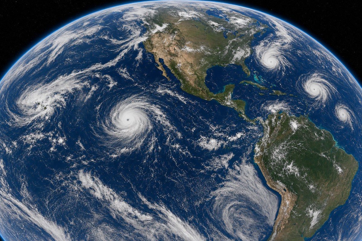
In Hawaii, Tropical Depression Moke passed approximately 300 miles south of the islands after being downgraded from a tropical storm. Wind gusts were forecast to reach up to 55 mph over the Big Island and 45 mph over Oahu and Kauai. Portions of the Big Island and eastern Maui were forecast to receive an additional 3 to 6 inches of rain through Monday, bringing total rainfall on parts of the Big Island to 15 inches. The hurricane center warned the rain could cause life-threatening flooding and mudslides.
Tropical Storm Iselle formed on August 23 well off the Mexican coast. As of 5 a.m. August 25, it had 60 mph winds and was located 540 miles southwest of the southern tip of the Baja California peninsula. Iselle is forecast to briefly reach hurricane strength while moving northwestward without threatening land, then weaken to a tropical depression within five days. Four additional potential storm areas were being monitored across the Eastern Pacific. In the Atlantic, an area of showers and thunderstorms about 400 miles southeast of Bermuda had a 50% chance of forming into a short-lived depression or storm over 48 hours as it moved northward, and a tropical wave expected to move off the coast of Africa was being monitored as it moved westward at 15 to 20 mph across the eastern and central tropical Atlantic. Meteorologists noted that strong winds associated with El Niño in the Pacific have made it difficult for major storms to form in the Atlantic this summer, while cautioning that hurricanes have formed during past El Niño summers.
Industry impact & what to watch
A basin carrying nine tracked systems at once is the kind of setup that turns routine weather avoidance into a scheduling problem, since crews and dispatchers have to hold multiple storms in view rather than plan around one.
Hawaii traffic sits closest to an immediate effect: Moke's rain bands and gusts up to 55 mph over the Big Island point to runway wind and visibility limits, ramp handling slowdowns and possible ground stops at island airports through the rain event, even though the depression itself stayed offshore. Iselle, by contrast, is forecast to stay over open Pacific water without threatening land, so its main relevance is to operators routing near Baja California and the Eastern Pacific corridor rather than to any airport closure.
The two Atlantic systems remain unresolved: the disturbance near Bermuda carries a 50% formation chance over 48 hours, and the African tropical wave is still just being monitored as it crosses the tropical Atlantic. Whether either organizes into a named storm, and how far it tracks before doing so, will determine whether East Coast or Caribbean-facing schedules need contingency planning in the coming days.
Who this affects
- Business Charter Operators — Flights into Hawaii face wind and rain-driven delay risk while Moke's remnants pass south of the islands.
- Charter Brokers — Clients booked into Hawaii should be warned of possible weather delays tied to Moke's rain and gusts.
- General Aviation Airports — Island airfields face temporary access disruption from Moke's wind gusts and heavy rainfall.
The underlying facts come from the originating publisher (linked above). The narrative, industry-impact assessment and per-role analysis below are produced independently by the AVI-GO intelligence team from public information. Cite as: AVI-GO, "Hurricane Forecasters Track 9 Systems Across Atlantic and Pacific on August 24" news brief, 2026-08-25.
How to cite
AVI-GO, “Hurricane Forecasters Track 9 Systems Across Atlantic and Pacific on August 24”. https://ai.avi-go.com/news/ai-news-center/news-briefs/hurricane-forecasters-track-9-systems-across-atlantic-and-pacific-on-a-b8a9205602b3e2fe21cb49853a9c81f0
Figures carry an explicit measurement window — cite the window shown on this page, not the date you retrieved it.