Typhoon Saudel Reaches Category 4 Intensity, May Enter Philippine Area of Responsibility on August 23
Typhoon Saudel intensified to Category 4 by 18:00 UTC on August 22, with JTWC reporting 215 km/h winds, as PAGASA warned it may enter the Philippine Area of Responsibility on August 23.
Original report
www.facebook.com
Industry impact
A powerful typhoon approaching the Philippines and Okinawa signals potential disruption to regional business aviation traffic, airport operations and flight scheduling across the affected corridors.
Typhoon Saudel intensified to a Category 4 typhoon on the US Saffir-Simpson scale as of 18:00 UTC on August 22 (2:00 AM Manila time on August 23). The Japan Meteorological Agency reported sustained winds of 155 km/h with a central pressure of 950 hPa, PAGASA reported 175 km/h, and the Joint Typhoon Warning Center placed 1-minute sustained winds at 215 km/h with a central pressure of 956 hPa.
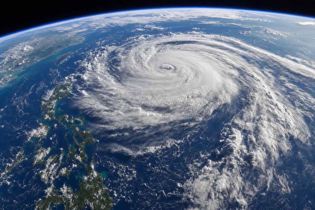
PAGASA issued its first tropical cyclone advisory for Saudel on the evening of August 22, warning the typhoon may enter the Philippine Area of Responsibility on the afternoon or evening of August 23, either as a super typhoon with sustained winds of at least 185 km/h or just below that threshold at 175 km/h. The storm will be locally named Pilandok if a tropical depression east of the Visayas enters the area first, or Obet otherwise.
Saudel is undergoing an eyewall replacement cycle, and the Joint Typhoon Warning Center does not expect it to reach super typhoon status during this cycle, though a slight intensity increase is likely afterward. JMA forecasts the typhoon will pass through the Okinawa Islands on the morning of Wednesday, August 26, and residents there are advised to monitor updates.
The underlying facts come from the originating publisher (linked above). The narrative, industry-impact assessment and per-role analysis below are produced independently by the AVI-GO intelligence team from public information. Cite as: AVI-GO, "Typhoon Saudel Reaches Category 4 Intensity, May Enter Philippine Area of Responsibility on August 23" news brief, 2026-08-24.
How to cite
AVI-GO, “Typhoon Saudel Reaches Category 4 Intensity, May Enter Philippine Area of Responsibility on August 23”. https://ai.avi-go.com/news/ai-news-center/news-briefs/typhoon-saudel-reaches-category-4-intensity-may-enter-philippine-area-2827fdff9e8108e103e01fd5ceb683b1
Figures carry an explicit measurement window — cite the window shown on this page, not the date you retrieved it.