Typhoon Saudel approaches Philippine area of responsibility, may reach super typhoon strength; southwest monsoon drives Luzon rains
PAGASA said Typhoon Saudel, packing 175 kph winds and gusts to 215 kph, may reach super typhoon strength before entering Philippine waters around Monday, August 25.
Original report
www.philstar.com
Industry impact
Storm tracking well offshore still forces operators to plan around monsoon-driven rain and wind risk across multiple regions rather than a single storm path.
What happened
Typhoon Saudel was forecast to cross into the Philippine area of responsibility on Monday, August 25, and could strengthen into a super typhoon before entry, according to the Philippine Atmospheric, Geophysical and Astronomical Services Administration (PAGASA). Once inside the area of responsibility, the storm will be given the local name Obet.
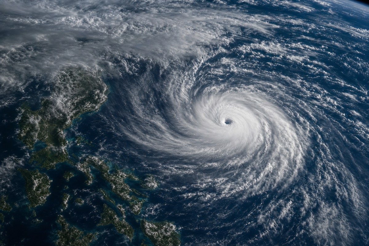
As of 3 a.m. Monday, Saudel was located 1,660 kilometers east-northeast of extreme Northern Luzon, with maximum sustained winds of 175 kph near the center and gusts of up to 215 kph, moving west-northwestward at 30 kph. PAGASA said Saudel is unlikely to directly affect Philippine weather or sea conditions over the next three days, and the typhoon is expected to remain over the Philippine Sea and exit the area of responsibility by Tuesday, August 26, though a more westward track could keep it inside beyond that date. After reaching peak intensity, the cyclone is expected to gradually weaken.
Separately, Monday's rainfall over Luzon is being driven by the southwest monsoon, or habagat. Batanes may receive 50 to 100 millimeters of rain, with possible flooding or landslides, while Metro Manila, the Ilocos Region, the Cordillera Administrative Region, Central Luzon, the rest of Cagayan Valley, Cavite, Batangas, and Rizal may experience scattered rain and thunderstorms that could also trigger flash floods or landslides. Moderate to strong southwesterly winds are forecast over northern and western Luzon, where waves may reach 3.4 meters. PAGASA is also monitoring two tropical depressions outside the area of responsibility: one located 1,330 kilometers east of southeastern Luzon as of 3 a.m., and Gaenari, formerly Tropical Depression Neneng, located 520 kilometers north of Itbayat, Batanes.
Industry impact & what to watch
This case shows how a distant, still-strengthening typhoon and an unrelated monsoon system can produce overlapping weather risk across the same airspace at once. Saudel itself is not expected to directly affect Philippine weather for the next three days, yet Luzon already faces scattered rain, thunderstorms, and southwesterly winds strong enough to raise wave heights to 3.4 meters along the northern and western coasts.
For operators flying into or over Luzon, the near-term hazard picture is dominated by the habagat rather than the typhoon's track, which means dispatch and routing decisions have to account for two separate systems evolving on different timelines. PAGASA's own uncertainty over whether Saudel exits the area of responsibility by Tuesday or tracks further west adds a second variable that could extend the affected window.
The two tropical depressions PAGASA is separately tracking, including Gaenari north of Itbayat, mean the monitoring picture will keep shifting over the coming days. Saudel's next PAGASA bulletin, and whether its track holds east of the Philippines or bends westward, will determine whether the current three-day no-direct-impact assessment still holds.
Who this affects
- Business Charter Operators — Monsoon rain and southwesterly winds across Luzon, not the distant typhoon, pose the more immediate operational hazard this week.
- Charter Brokers — Clients booked into Luzon this week face monsoon-driven flood and landslide risk separate from the approaching typhoon.
- Commercial Airports — Airports across Metro Manila and northern Luzon face monsoon-driven flooding and landslide risk this week.
The underlying facts come from the originating publisher (linked above). The narrative, industry-impact assessment and per-role analysis below are produced independently by the AVI-GO intelligence team from public information. Cite as: AVI-GO, "Typhoon Saudel approaches Philippine area of responsibility, may reach super typhoon strength; southwest monsoon drives Luzon rains" news brief, 2026-08-25.
How to cite
AVI-GO, “Typhoon Saudel approaches Philippine area of responsibility, may reach super typhoon strength; southwest monsoon drives Luzon rains”. https://ai.avi-go.com/news/ai-news-center/news-briefs/typhoon-saudel-approaches-philippine-area-of-responsibility-may-reach-ef23dbb229259d17c2de91ffa55c2fba
Figures carry an explicit measurement window — cite the window shown on this page, not the date you retrieved it.